We perceive a landscape primarily by our eyes (see Weidenbach 1999,
Chapter 3.2).
The visual perception is essential for the acceptance or refusal of
planning proposals (see Weidenbach 1999,Chapter
5.2.3).
Therefore the realistic illustration of planning proposals or natural
landscape changes is an important task of landuse planning and images are
the adequate medium for a succesful communication between planners and
the citizen (see Weidenbach 1999, Chapter.
5.2.2).
The following samples show the capability of GIS and Multimedia applications
for multidimensional landscape visualisation:
1. Three-dimensional virtual landscape
models (VRML) which, can be displayed with e.g. Cosmo
Player (implemented plug-in of Netscape 4.0 and higher):
---> Click on the corresponding
image.....
Virtual Reality Model with Top. Map 25 and GIS
Objects (ca. 0.5 MB)
Virtual Reality Model with Top. Map 25 and Orthophoto
(ca. 0.5MB)
.
Virtual Reality Model with GIS Objects (ca. 1MB)
.
GIS Objects and Top Map (no Virtual Reality Model)
GIS Objects and. Orthophoto (no Virtual Reality
Model)
.....and see another example
in Weidenbach 1999, Chapter
4.3, S.106
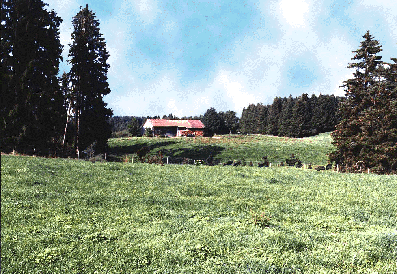
2. Flash-Animation of different silvicultural systems: [Click here!]
3. GIF-Animation and photorealistic
illustration of landscape changes:
---> Click on the image.....
Growth simualtion of an afforestation (0.9MB)
.....and see the example in
Weidenbach 1999, Chapter
4.4, S. 122 u. 123